|
|
| |
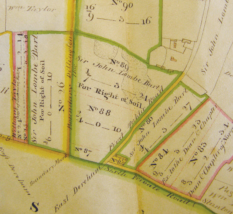 On the enclosure map of 1814, what appear to be extensive pits are shown in plot No. 89. [Courtesy of Norfolk Record Office C/Sca/2/243] For most of the nineteenth century, the brickyard was in the tenancy of the Kitteringham family. William was head of the family in the census of 1841 and they continued until 1891, when Downing Kitteringham was the manager. He also enumerated the censuses for Hoe in 1881 and 1891.  The OS map of 1882 shows the location of the kiln. 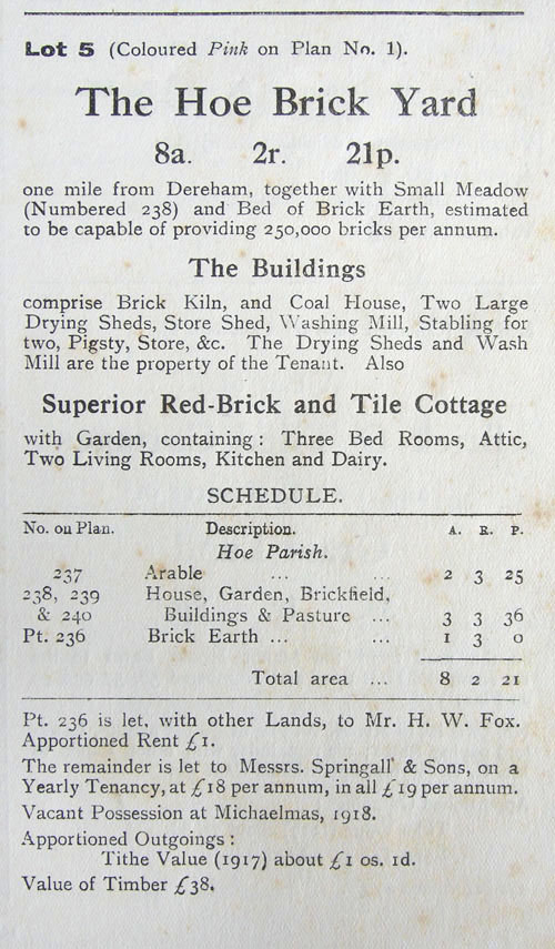 Sale
details and plan from the auction catalogue of the Sale
details and plan from the auction catalogue of the Bylaugh park estate, 1917. 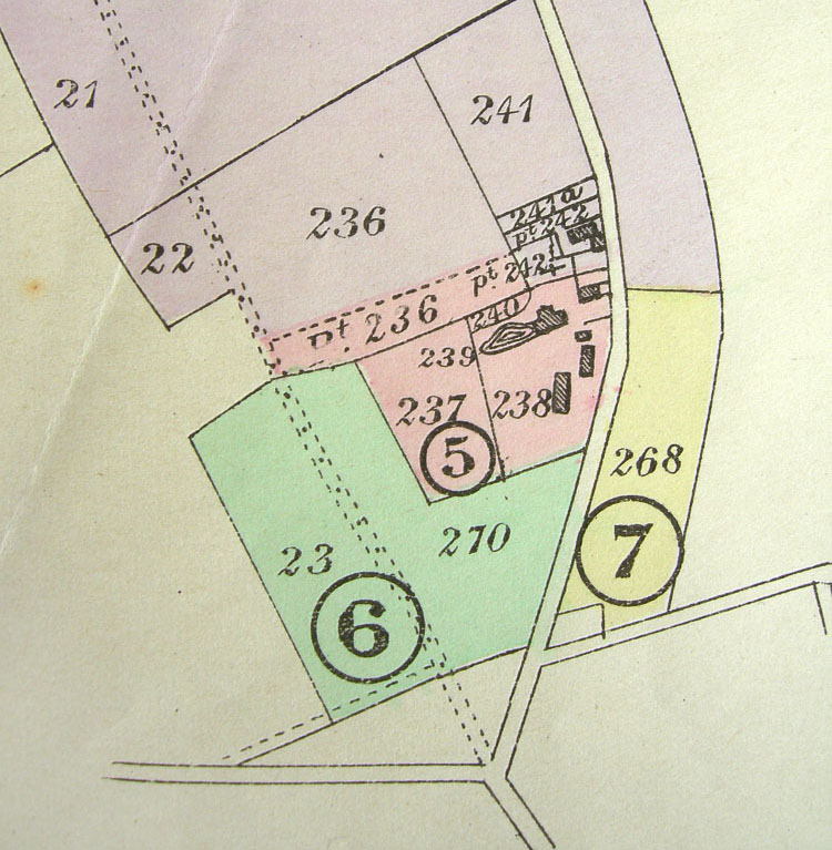 Plot 7 on the plan is described as ‘A piece of Market Garden Ground’. It was bought by a Mr E. F. Howard for £100. Perhaps he supplied the market in Dereham with produce.  June 1905
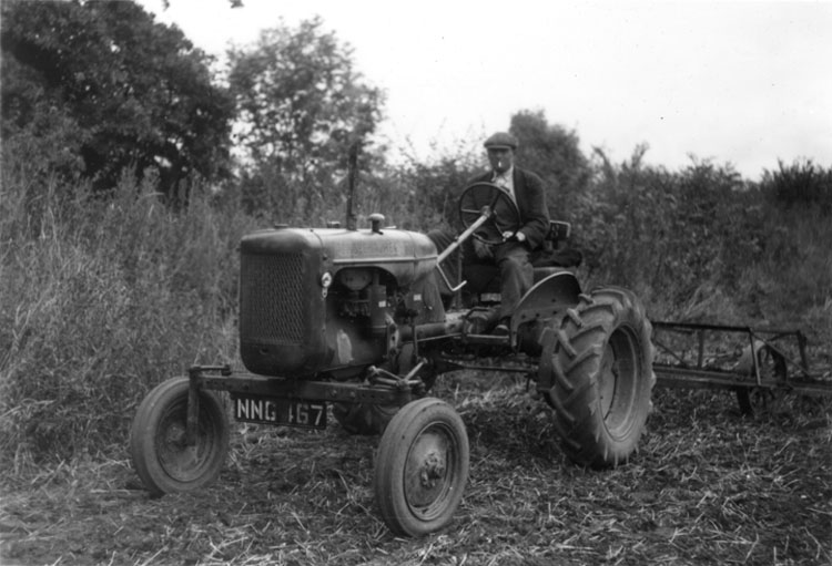 Alec Anderson lived most of his life at Brick Kiln farm cottages and worked at Dillington Hall farm. He was a dispatch rider in the Home Guard during WWII. This photo is from September 1952. 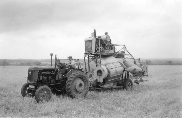 The first combine harvester in the area, a Claas. Originally without its own engine and powered by the tractor, it was modfied with the addition of a Ford industrial engine on top. Alec Anderson is driving the tractor. August 1952. 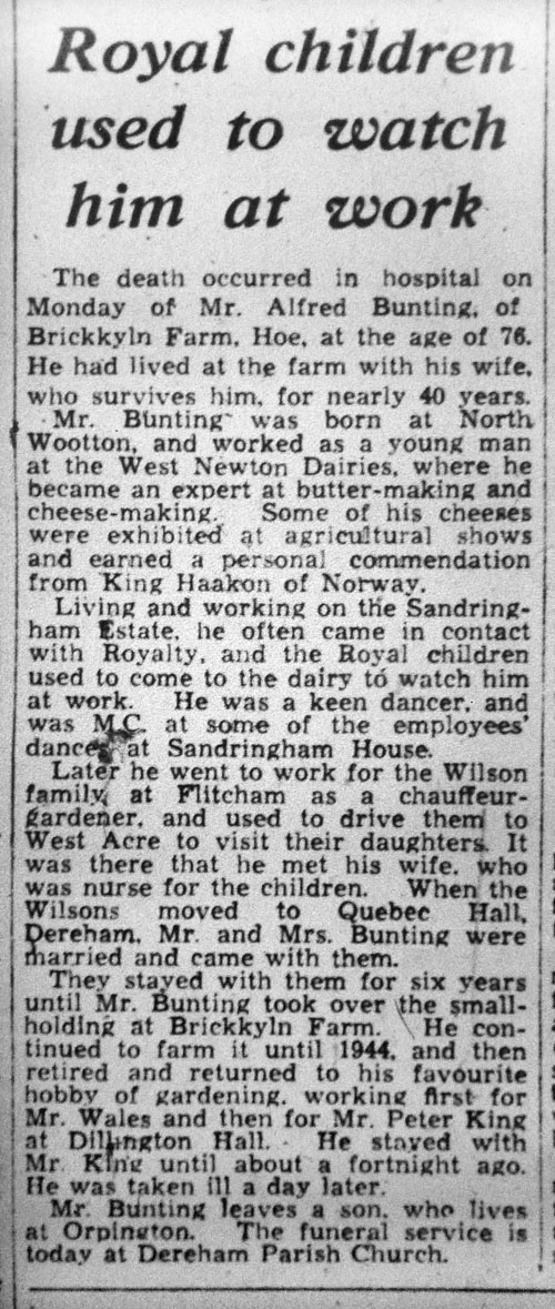 Alfred Bunting, March 1958
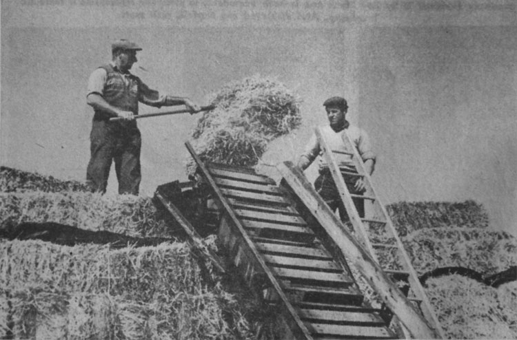 Stacking barley straw at Brick Kiln farm in August 1968. The newspaper report records a late harvest that year.  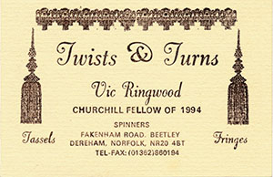 Brick Kiln farmhouse when it belonged to Vic and
Eileen Ringwood in
Brick Kiln farmhouse when it belonged to Vic and
Eileen Ringwood in the 1970s. They ran a business called Spinners in the small white building, selling fleece, yarn, dyes and spinning equipment. Vic and Eileen were both skilled weavers. Vic was awarded a Churchill Fellowship in 1994 to study the passementerie industry in France, becoming an expert maker himself, passing on his business, Twists & Turns, to one of his daughters on his retirement following a move to Beetley. 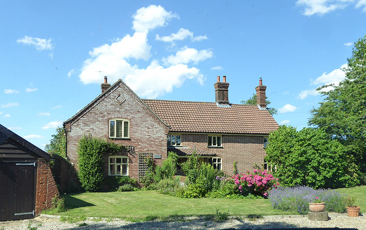 The house has been extended since then, but the Bylaugh estate chimneys still stand out.  Rabbit's Foot barn was converted into a house in the 1980s. It was formerly part of the agricultural buildings of Manor farm, Hoe. 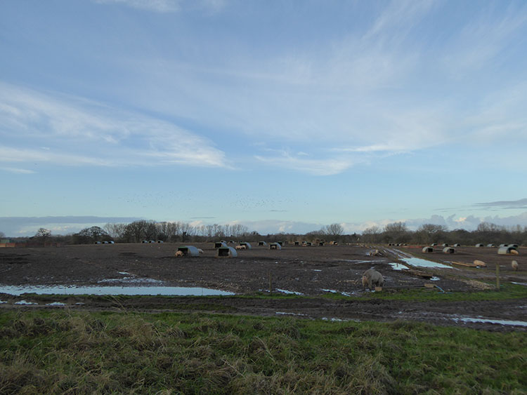 The highest land in Hoe is at Brick Kiln Farm, 64 metres above OD. The soil is lighter and sandier than elsewhere and on old maps is called Staunton Heath, indicating that it wasn't good arable land. On the map of the Helwys estate from the late eighteenth century part of it is marked as The Fold Course. 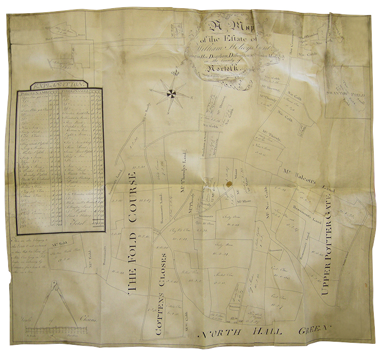 The Lord of the Manor had the right to graze the Fold Course with both his and his tenants' sheep. The land was only periodically cropped because it was poor soil, like the Brecks. The soil was fertilized by the animals and could then be cropped. 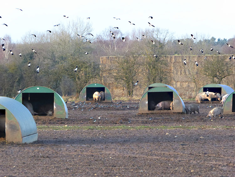 In recent years the land has been used for raising pigs outdoors. Flocks of wintering lapwings appreciate the disturbed soil. 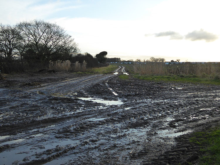 The heath, looking towards Dereham. The whole area, together with land at Gorgate and Gressenhall, including a wide range of habitat types, is the subject of an ambitious plan, the Wendling Beck Exemplar Project, to develop a farming practice attuned to environmental standards higher than those of conventional arable farming. The Wendling Beck Exemplar Project is a nature restoration project covering just under 2000 acres north of Dereham. It is a collaboration of four farmers, Norfolk Wildlife Trust, Norfolk County Council, Norfolk FWAG (Farming & Wildlife Advisory Group) and Norfolk Rivers Trust. It is supported by The Nature Conservancy, Natural England and Anglian Water and is a story of habitat creation, river restoration, social impact and regenerative agriculture, all at a landscape scale.https://www.wendlingbeck.org/ |
|